Following Progress
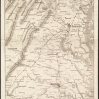
"Panorama of the Seat of War, Bird’s Eye View of Virginia, Maryland, Delaware, and the District of Columbia," 1861. Courtesy of the Norman B. Leventhal Map Center at the Boston Public Library via Digital Commonwealth.
During the war, commercial firms published a variety of war-related maps for the general public. Maps showing the seat of war were to be used by those following the progress of the war when they received news by newspaper or telegram, a new technology which gained wide acceptance during the 1840s and 1850s along with the nation’s expanding railroad network. Large graphic representations, while not very useful for planning military maneuvers because of exaggerated topography and inconsistent scales, were useful in assisting a living room audience to visualize the geographic areas where the battles would eventually occur.


